Overview
Contents
Overview#
Purpose and Function#
The MAJIS science operations team will use GFINDER, in concert with the other MAJIS Operations Simulator system components, during the different planning activities of the mission, to support the planning MAJIS operations that must result in:
Highest possible scientific value observations and data products (data cubes), and that are
Not conflicting with JUICE platform and other scientific instruments constrain
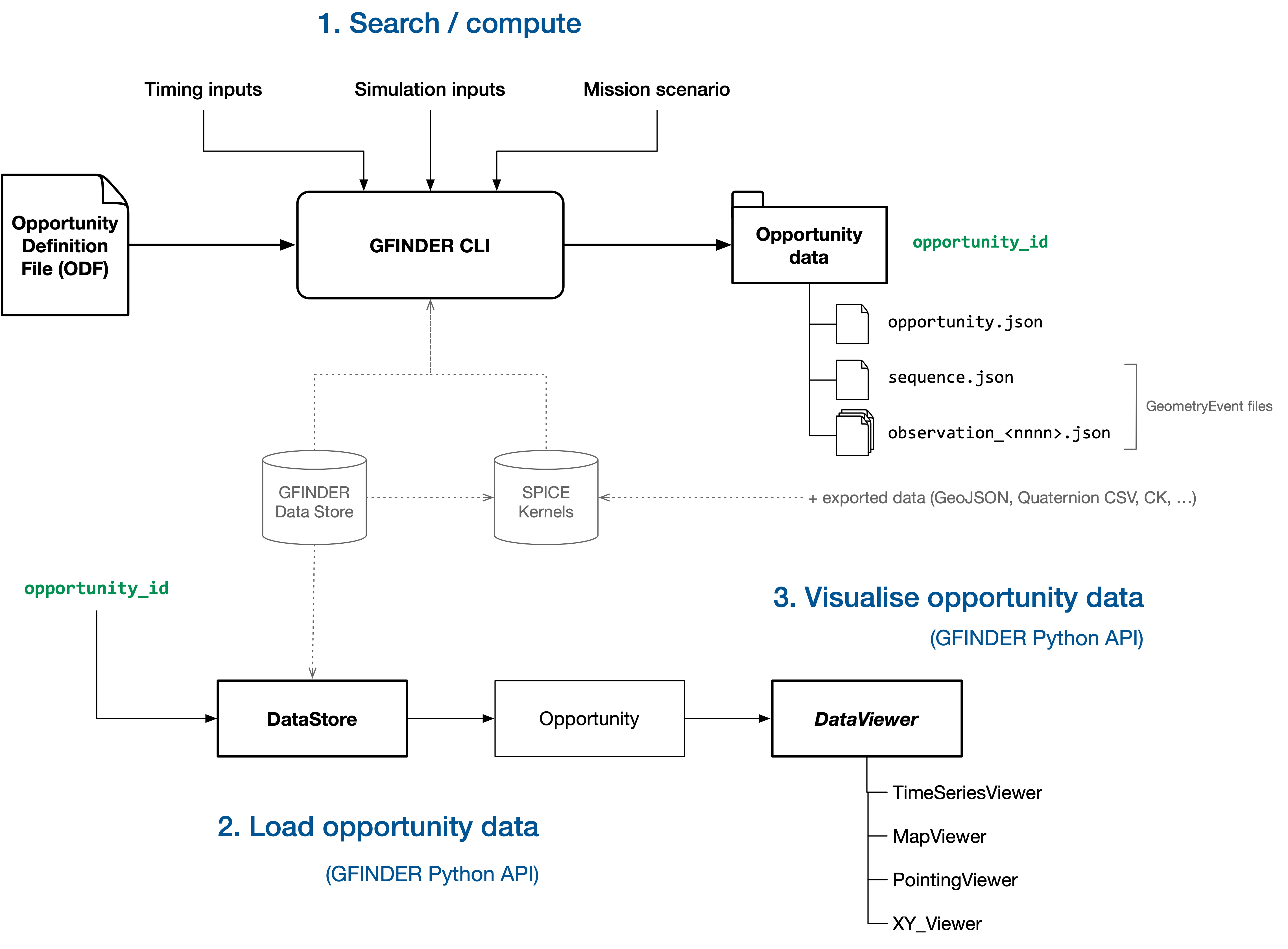
The main functions of GFINDER are to:
Define observation geometry and geometrical conditions
Find times of observation opportunities, for a given phase or segment of the mission
Compute observation opportunities geometry data
Visualise observation opportunities geometry data
Manage input and output application data (calculations definitions and results)
See MAJIS Science Operations Planning to better understand the context of use of GFINDER.
Usage#
GFINDER consists of a Command Line Interface (CLI), a Python Application Programming Interface (API), and a Web application (in development).
It is currently usable for people having basic knowledge and skills related to shell/terminal environment, and with Python programming and JupyterLab environment.
It is intended to provide all computation and visualisation functionalities through a single Web application (currently in development).

See Using GFINDER.
